>Pellicer Creek

>

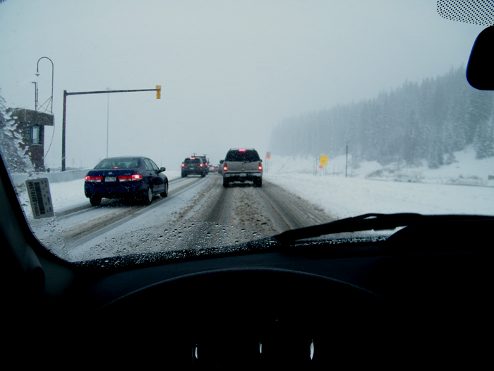
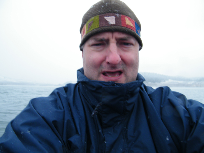
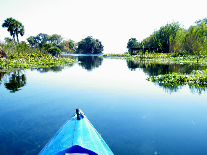
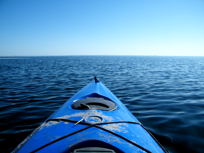
As in space travel, paddling for me is measured in time, not distance. For instance, five miles downstream may be an hour, but the same distance upstream may be three hours. The five miles itself is essentially meaningless. Such was the case with the strange, perplexing, counter-intuitive Pellicer Creek. Creeks, even tidal creeks, are supposed to flow to the sea, right? Near as I can tell, Pellicer (a creek wider than the Oklawaha and Santa Fe Rivers combined in places) does not–or so I found out when I decided to turn around after 1.5 hours of relatively easy downstream paddling.

The return was brutal, an against-the-current workout with a stiff 25-mile-per-hour headwind the whole way. I realized there are circumstances where I could be paddling with all my might and gain no progress whatsoever. Suffice to say I was done paddling an hour before I actually made it back to the put in. When I got back, a fisherman asked me what it was like to paddle against the current. I told him I hadn’t realized an upstream return was in the cards until I had turned around.


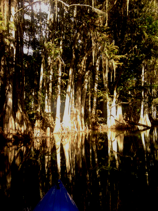
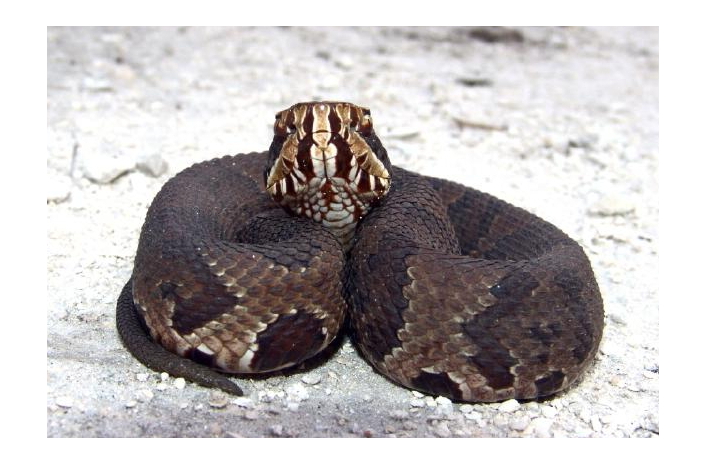
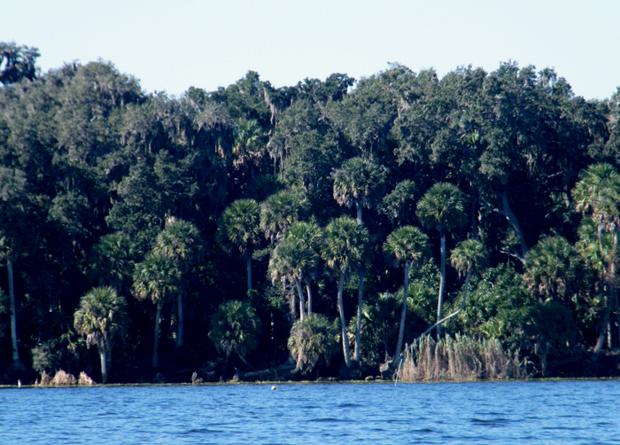
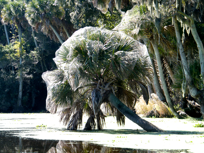
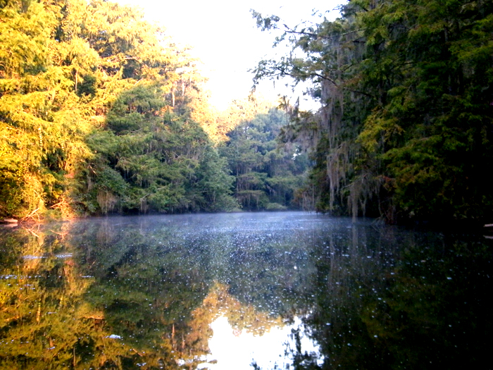
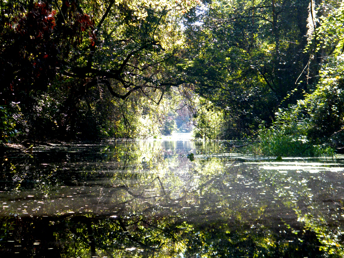
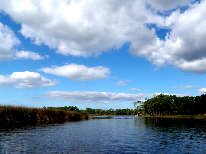
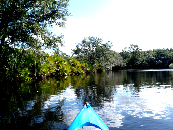
The creek is salt marsh the entire way. I know because I tasted the water. Marsh grasses lined both sides, with only the occasional isolated forest on the south side to break up the landscape. My familiar paddling companion, the kingfisher, was there to berate me most of the way. Other than that, and one Great Blue Heron and one bald eagle, I saw no wildlife–unless you include the shirtless, portly gent who spoke to me from his deck.

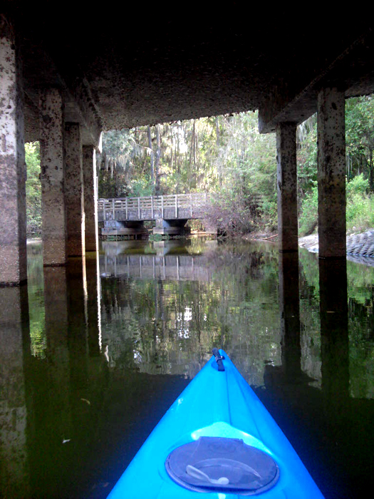
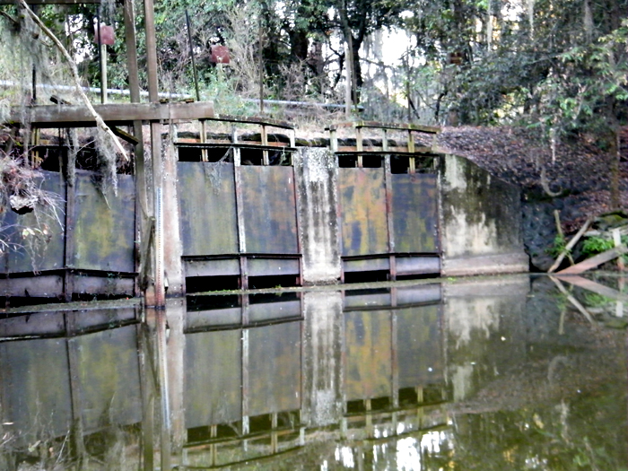
Pellicer runs under I-95 and Route 1, which in itself was strange. As soon as I thought I had broken through to some wilderness, a major interstate and a stand of billboards crosses my path. I wanted to continue past Route 1 (and I am really glad I didn’t) because it looked like things were about to get a little more interesting. I did have a bit of a revelation, though. I wonder if it may be possible to carry a makeshift sail with me on my boat. With the wind as it was, I believe I could have reach hull speed very quickly. 


Nevertheless, a day paddling to exhaustion is a good day. I find myself, however, increasingly addicted to the wilder aspects of it. I want to get lost. I want to go where there is no easy route back to a state park parking lot. I want to go where I see no evidence of human presence, not even a floating beer can. My favorite nature writers begin at such places and I crave going where they have and have not.

>Oklawaha River – Gore’s Landing

>

Election days depress me. No matter if my guy is winning or not, I’m still reminded how separated I am from my fellow human beings. So I voted, took the afternoon off, and headed out to the river. I had originally planned to do an overnight to escape the fallout, but that didn’t come through. A few hours would have to do.


I wanted to enter the river at one of the less popular places (the Silver River and Eureka launch points are typically quite busy). Gore’s Landing is about halfway between these two and way off the beaten path. I was the only one there, but I still ran into two motorboats on the river, one going faster than I have ever seen a motorboat go down a river. The Oklawaha is clearly a major artery for area fishermen. On this same river several weeks back, I passed a man standing up in his boat fly fishing, casting his line again and again. I asked him if he was using bait or a fly. He replied that he was using neither and that he simply liked the meditative act of repetitive casting. A kindred spirit.

The river north of the Silver River is also abundantly spring-fed, so the water is mostly clear (hence my first underwater shot above) and a strenuous upstream paddle. I stopped often to recover and also to scout for possible camping sites. The places I saw seemed marshy and riddled with what looked like piles of bear feces (thus solving the age-old bear-shitting-in-the-woods quandary, but also arguing strongly against camping here.) It is also clearly someone’s priority to keep this part of the river navigable, as I saw many cleared and uprooted trees along both sides of the banks.

The bonus of a vigorous upstream is a heavenly downstream return. I reclined and floated the entire way back and arose just in time to see my launch point go by. My wish for everyone, political friends and enemies alike, is to enjoy such a float sometime. It clears the cobwebs, slows the blood flow, calms the nerves, soothes the knitted brow, and restores the republic.

>River Styx Redux

>

It is clear to me now that I am obsessed with River Styx and have been ever since I heard the name associated with this area. Like its mythological namesake, it is mysterious, dark, impenetrable. You know those dreams where you’re wandering through a house that is supposed to be yours, but you don’t recognize it, and every time you open a door you discover a new room? River Styx is like that. Well, the section north of the 346 bridge is like that. The section running south to Orange Lake is beautiful in its own right.

The first thing that greeted us this time was a mass of bloated deer entrails floating in the water, clearly thrown out there for the gators to clean up. As they had obviously been there a while, I concluded that the area gators had departed for higher water (except for an adorable foot-long one sitting on a log). The vultures were driven to distraction watching this feast float there untouched and they with no evolutionary apparatus with which to access it.


Ah, but the north side. Maps for this area show a vast, open waterway, but the reality is a narrow trail, lined by rich thatches of cattail? Wild rice? At any rate, they served as doors to the next “room.” Every time we thought we’d come to the end, we’d break through and another section of the river, utterly unlike the one before it, would reveal itself. There is something primal, childlike, and frightening about the effect this had on me, and I’m not entirely certain I’ve found the words to describe it yet. I do know that the experience fascinated and haunted me for the rest of the day and into the night.

As this this part of the journey did not wear us out, we decided to attack the south part on the way to Orange Lake.  This did, in fact, wear us completely out, especially with the sun bearing down on us the whole way. I have noticed this phenomenon where, so close to the surface, it is difficult to judge distances. In this case, no matter how far we progressed, the treeline at the edge of the lake remained the same distance away. Finally, we turned around and used the last bit of energy we had left to get back and rack the boats.


>Prairie Creek

>

Prairie Creek is a dark, mossy, foreboding, silent, and beauteous place. Connecting (allegedly) Newnan’s Lake with Camps Canal and thus River Styx and Orange Lake, it has attracted and frightened me from the beginning. Wetlands Scientist Friend (a man not given to hyperbole) warned me a while back that this was a place where water moccasins drop into your boat. With web-laden branches that hang two feet off the water in places, I could easily see how this could happen. In fact, the first thing I saw when entering the creek from Newnan’s was a water moccasin sunning itself on a cypress strut (more on that later). This is not a place where you want to run aground.


The part of Prairie Creek that had always scared me the most was the Second Bridge. The first bridge is tall and holds Hawthorne Road above the creek. The second bridge is much smaller and supports the Gainesville-Hawthorne trail–and is much closer to the water, as in scraping-up-against-mud-dauber-wasp-nests closer. Thanks to a ornery mood before putting in, and near-record-low water levels, I was ready to shoot the gap, which I did without incident.

Prairie Creek on the other side of this bridge is another world altogether. The water goes from a milky jade to a cesspool brown. The creek itself narrows and become cluttered with tree falls and detritus. This paddler felt like he was entering the Heart of Darkness right there in Payne’s Prairie. There was more to discover downstream, but after about 1/2 mile I turned around and headed back.

You will have to trust me when I say the picture above is of a water moccasin. I thought I had captured it but apparently my boat was about to collide with the selfsame tree said moccasin was chilling in. Hence, the shot of the water and the starboard side of my boat. One of the many scary things about water moccasins is they blend in so well with their surroundings. This one was akistrodon piscivorus conanti, the species associated with this area, and it looked like a muddy, muscle-bound walking stick. But the pit viper head was unmistakable. I want to go back and get a better shot of it.

Paddling back out into a uncharacteristically calm Newnan’s was like walking into my own living room after an especially scary dream. The breeze can only be described as sweet and, as I was paying close attention, scented with the cypress that rings the lake. This is home.


>Horsetooth Reservoir, Ft. Collins, Colorado

>

I’ll start this one from the end. As I was de-boating back at the ramp, I stepped into knee-deep, wet, sandstone clay, fell over, and dropped my camera onto the concrete ramp. It managed three awful bounces before it came to rest near the water. I’m getting a “zoom error” now and I fear it may be the end of my camera. Had this happened pre-paddle, I would be distraught right now, but I got all the shots, and who knows it may work again, but most cameras aren’t designed to bounce.

Navigating Horsetooth was entirely pleasant. The weather was everything yesterday’s was not: sunny, clear, breezy and I could see for miles. Miles before I approached Horsetooth, I could tell it used to be a sandstone canyon, now a reservoir, thanks to the damming of four separate rivers. Although this knowledge haunted me the whole time, I was able to get to the place I like to get to when I paddle–a lazy, timeless, meandering state of mind.


The sound of cold lake water sounds different against the paddle than the warm water back home. And cold it was. I ran my hand along the boat and the water ran down my sleeve and stayed cold. Yet it was warm enough that, an hour in, I had to take off my jacket and paddle in my t-shirt. When the sun disappeared behind the clouds later, the temperature dropped 20 degrees.

I wandered into one of the many inlets and pulled up to hike up the hill and listen to the wind blowing through the cottonwoods. Canadian geese and wood ducks were resting nearby, clearly acclimated to the presence of human beings (houses lined this part of the reservoir). All of Colorado is under a long-term drought and evidence was everywhere of the effects here. The level was at least 30 feet lower than it was supposed to be. For a reservoir 200 feet deep, though, it had some room to spare.


I spoke to some fishermen on the way back, who asked me if I were fishing from my kayak. I wasn’t, as the hotel does not come equipped with a stove or grill, but the very suggestion made me hungry, and someday I would like to catch my dinner from my boat back home, which is where I am headed now.

>Dillon Reservoir, Colorado

>

Just getting here turned out to be the riskiest part of this outing. Front Range weather has always been schizoid. I’ve seen afternoon snow in June in Denver on the same day I wore shirt sleeves in the morning. In this case, it was 60 degrees in Denver, but by the time I headed up Route 40 to Grady Lake, the temp had dropped to 28 and snow and ice covered the entire road. I knew I had 5 miles of switchbacks ahead of me, so this Florida boy turned around and headed back down to Dillon, my Plan B. Just as bad if not worse. Cars all over the road and shoulders. But I had no choice but to push ahead to Dillon, as there were no exits until then.

I got there, got my boat checked at the ramp (they have an invasive mussel issue here), and slid uncomfortably into a strange boat. I felt like I was cheating on Big Blue. This one liked to pitch and most of the paddling was actually correcting the bizarre current and chop on this lake. Oh, and it was freezing cold and windy. Falling into this water would have literally been a matter of life and death. On my way out into the lake, I passed a large sailboat. The man at the wheel said “Great day, isn’t it?” He wasn’t kidding and I had to agree. A day spent on the water, in radical acceptance of the elements, is a good day indeed.

I’ve studied the DeLorme, combed every website I could find, and have now paddled some of it. I can go ahead and claim that Florida is much better for flatwater paddling than Colorado–and it’s not even close. A dry state, Colorado does not have a plethora of natural lakes. It has rivers, but those are dry much of the time. Paddlers here concentrate on whitewater kayaking almost exclusively. That’s fine, but for my meditative needs, the daredevil stuff falls short. 


Nevertheless, I plan to hit it again tomorrow and hope to have more visibility and calmness.

>Lake George at Silver Glen Springs

>

I’ve lived in Florida for 22 years and had never seen Lake George (second in size only to Lake Okeechobee, which I have also never seen). So thanks to a little extra weekend driving time, I am no longer a Lake George virgin. It was an experience as big as its size. I write this a spent man, burned and exhausted.

The far shore on Lae George is so distant that to these aging eyes it might well have been the water horizon itself. In fact, everything about Lake George seems a mix of salt water and fresh water: the sandy bottom, the abundant palms on shore, the chop. The water itself is surprisingly clear, with visibility up to three feet or so, and made for a show the whole way. Occasionally, beside me I would see a large disturbance in the water and would look over, hoping to see what gators do when they are trying to get away, but I saw nothing but the churned up bottom.

It took a half mile’s paddle past a flotilla of yachts and leather-skinned dowagers to actually get from the springs to the lake. The springs is the clearest water I’ve ever put my boat in, schools of mullet streaming past underneath, many of them jumping two feet out of the water. Finding where the lake proper begins is obvious, as the water goes from glass smooth to choppy immediately.

I found myself haunted the whole time by descriptions of two of the areas great chroniclers William Bartram and Majorie Kinnan Rawlings (the setting for The Yearling is right where I put in.) Minus the McMansion boats and buoys, Lake George remains exactly as they described it. Bartram especially waxed poetic about his desire to stay and continue to discover this bounty, and I confess I felt the same. I wanted to spend however long it took to investigate every inch of this shoreline, no small task on a lake 12 miles long and 6 miles wide.

The caterpillars have claimed a good piece of the shoreline I did visit, as many of the trees were completely sprayed in webbing. As I recall from my childhood, this does not kill the trees, but something looked out of kilter about it. Perhaps the caterpillar/butterfly has lost a natural predator?


I will come back here, that is for certain, but it will need to be for days, not hours. At the National Park store in Salt Springs, I bought a detailed map of the Ocala National Forest and the paddling options are so numerous that I lost count. It is also one of the few places left in Florida where one can legitimately get lost in the wilderness. Oh, what a joy that would be. Seriously.

>Newnan’s Lake – Northwest

>

As I’ve intimated before, Newnan’s has different personalities depending on where you put in. The NW quadrant is only part I had not visited, so I jumped at a friend’s offer to put in at his place and had anticipated it for weeks. So by the time I pulled up his yard, there was nothing that was going to stop me from getting into the lake–including 20 yards of thick, scratchy vegetation that I had to will myself through. I have no idea what it is, but ants and at least five different species of spider absolutely love it. I am still picking dried bits of it out of my hair as I write this.

By the time I broke on through to the other side–bravely trailblazing a path for my paddling companions–I saw that this part of Newnan’s displayed its lower levels more than any other. Barrier tussocks line the entire NW edge and we mostly stayed between them and shore, as the sun was still fierce at 530PM. Dead hydrilla lined the surface in clumps, and we were greeted by a strange array of trash, some of apparently freed from decades long bondage. I grabbed a floating Coke can with a pull tab, something I had not seen since the late ’80s.

On the north shore, the lake changed once again, as the water cleared and the tussocks became less prominent. We found a creek that I haven’t been able to locate on any map and paddled into its dark canopy. My friend’s canoe drew too much water to make it very far, but I was able to progress down a few hundred yards or so until fallen trees prevented further exploration. My wetlands scientist friend has told me tales of snakes dropping into boats in places like these, and I must admit I would have welcomed such drama. As I told him, the more I paddle, the more wilderness I crave.

We took the open lake back to where we entered, which was thankfully next to a gathering of lily pads, else we probably wouldn’t have found it before dark. The sun blinded us to everything above the surface, but not to the occasional gator bubble trails. I’ve been told that Newnan’s gators have adapted to the hunters, staying farther offshore than they are accustomed to take advantage of the numerous avenues of escape that open water provides. In fact, we saw none between the shore and the tussocks, only on the open water.


Most jets taking off from and landing at Gainesville Regional Airport bank over Newnan’s, and we saw several (some of which I mistaked for airboats). I wonder if they can see us there below tooling around, noticing how Great Blue Herons are loners and ibises always travel in twos.

>Camps Canal to Prairie Creek

>

Camps Canal was constructed in 1927 to divert water from Prairie Creek into Orange Lake. Theoretically, waterways do exist from Newnan’s to Prairie Creek to Camps Canal to River Styx to Orange Lake, but getting from lake to lake in a kayak would be a superhuman feat at this point. So I consider these forays down Camps and Prairie Creek to be research to find the North Central Florida equivalent of the Northwest Passage. This time I was committed to paddling the Prairie Creek end of the Canal until I could go no farther.

I have yet to head down Camps Canal without observing alligator behavior that I haven’t elsewhere. This time a gator big enough to create a large wake even when it was under water pulled out in front of my boat and swam in front of it for 100 yards or so. Even when it submerged, it continued in front of me (and, guess what, a gator can outpaddle anyone) and seemed to refuse to let me pass. I would have happily done this the whole way down the canal, but it required all my concentration. Eventually, I splashed my paddle and it pulled to the side, submerged, and let me pass. Later, at the end of the canal, I paddled into the low canopy among the cypress knees to see if it cleared up ahead and another, smaller gator appeared and swam rapidly right for me. Another day perhaps.

About halfway down, I heard the first sound of Fall in the form of a Sandhill Crane in the prairie off my port bow. For adults in this area, this sound is the equivalent of an ice cream truck’s calliope. It brings them running outdoors to find its source. For me, there is no finer sound in nature.


Update on “Harassed on Newnan’s: Yesterday, as I was getting ready to leave the Orange Lake ramp at MKR, I saw a man standing next to the same truck I spotted at Newnan’s that day. I went up and introduced myself and was able to apologize to him face-to-face for misjudging his intentions and writing about it. He could not have been nicer. I chatted with him for about 15 minutes and learned more in that time about invasive species than I ever knew before. It sucks that I had to make a friend by shooting first and asking questions later, but what are you gonna do if you’re me?


>Alto-Santa Fe Canal

>

The last time I pointed my boat down this canal, it looked to be more trouble than it was worth, especially near sundown. It appeared to be overgrown and thick with ominous shadows. So it was that I was expecting a good, old-fashioned bushwhacking expedition today when I paddled it with some friends. We even brought along a chainsaw and some clippers, but we never got to use these, because the canal is completely navigable all the way through to Little Lake Santa Fe.

First you have to plow through a long carpet of duckweed, but this was no impediment and it felt as if we were paddling across a football field. About a mile down, as we passed under the surprisingly huge bridge at CR1471, we detected the trademark stench of carrion, along with the largest flock of turkey vultures I have ever seen. Whatever it was, we knew from its smell it had to be bigger than a possum. After the trip we hiked a short way through the woods to find out what it was and saw what appeared to be a large deer skeleton.

Water birds love this canal, situated as it is between one largish and two extra large lakes. We were never out of sight of a heron or anhinga. I also had my first sighting of a tri-colored heron. When we broke through to Little Lake Santa Fe we were greeted by a man on a Jet Ski asking about alligators, of which we saw exactly zero. The canal appears well used, as folks before us had clearly done the clearing of it that we came to do.

I love that this canal exists, and it has apparently since 1881. Back then it was wide enough to accommodate steamboats and to encourage commerce between the two lakes. To this day, there remains a world of difference between the two lake communities. Lake Santa Fe is the location of choice for the well-heeled lake dweller, and Alto serves Waldo, a town that after 22 years of living in the area I am still unable to define.


I’m still trying to convince these guys to satisfy our bushwhacking jones on the River Styx, where I know we will have some cutting to do.